| Home Products Charts Weather Specialist/oem Training Contact us |
| World-wide Charting |
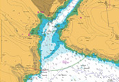
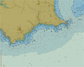
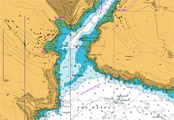
seaPro is a ‘multi-fuel’ charting system that utilizes both vector and raster chart formats to provide you with the best choice of quality charts wherever you are in the world. Simply select the charts that suits your geographic location and format preference. Charts supported by Euronav offer quality, detail, accuracy and coverage in standard formats that are regularly updated. For GIS (Geographical Information System) users, Livechart and S57 vector charts are also available in various formats such as GXF and Mainfo. Vector chart formats Livecharts - are quality vectored charts that faithfully reproduce the color, accuracy and detail of standard hydrographic office paper charts in a vectored and layered format offering total flexibility not possible with paper charts. Seamless chart selection and the ability to automatically select detail relevant to zoom level or as defined by the user. A complete Livechart catalogue is available within seaPro and on the seaPro demo CD. Livecharts can be purchased in packs covering an area, with special National packs giving great coverage at a very effective price S57 - is digital data produced by hydrographic offices and other official sources of chart data. This chart format will eventually replace paper charts. Although availability world wide is limited, coverage is rapidly improving especially in Northern Europe and the USA. S57 charts are supplied either in an encoded format (copy protected) or in a non-encoded form. Euronav is a distributor for both Primar and the UKHO S57 data. Raster chart formats They are relatively low cost to produce, and coverage is consequently very good. HCRF format: ARCS - are official raster charts produced by the British Admiralty which offer world-wide coverage. An ARCS catalogue is provided within seaPro and on the seaPro demo CD. The charts can either be purchased outright (skipper service) or leased with an update service for a year (Navigator service). For current listing and availability Seafarer - are official raster charts produced by the Australian Hydrographic Office which cover Australasian waters. BSB - Available from a number of manufacturers throughout the world, the prime supplier is Maptech (especially in the USA) including the new BSB 4 version Note: There are a number of BSB 'dialects', most are supported but compliance with non-Maptech BSB cannot be guaranteed. Euronav is a distributor for the above products Maptech PCX - some older chart formats such as PCX are supported, but not recommended due to the age of the data.
|
|
| Euronav AS Postboks 195 - 1325 Lysaker Norway |
Phone: Fax: E-mail: |
67122030 67122031 sveinh@euronav.no |